Day 5: Cut & Fill
Activity Instructions
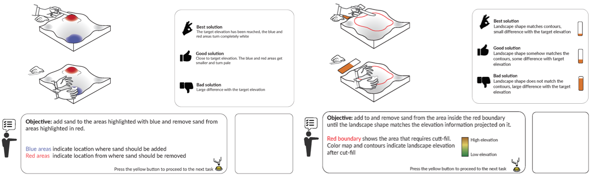
The cut and fill, i.e., earth moving, lesson will consist of two tasks: basic modeling using elevation difference feedback and advanced modeling using elevation contours with numerical feedback. For the basic modeling task, students must modify the given landscape using cut and fill projection. Students work off of the projected elevation difference of the existing landscape and the expected landscape (computed by subtracting the scan from the DEM of the expected landscape and projected as red and blue colors). Specifically, blue indicates areas where sand should be added (fill) and red indicates areas where sand should be removed (cut) either by hand or with a sculpting knife. The color intensity indicates the magnitude of difference and will turn white if the target elevation is reached.
Resources
Activity Objectives
Cut & Fill Activity
Geospatial Concepts
Geospatial Concepts Covered by Cut & Fill Activity